Showing posts with label American Alley. Show all posts

Friday, November 13, 2015

We’ll Talk About Murals, But Only After Transit

I promised that today’s post would be about the murals newly adorning American Alley in Petaluma.  And it will be, but only after I chat about a transit issue that is even more essential to the future of Petaluma.  It’s a challenge that will be faced by many North Bay communities in the coming year.

I sit on Petaluma’s Transit Advisory Committee.   As such, I’ve had a front row seat for the magic that the Petaluma Transit staff has worked over the past few years.  With less than two-an-a-half full-time employees, transit ridership had nearly tripled since 2010.  Rider satisfaction is increasing.  The bus maintenance facility was expanded.  And technology such as an automatic vehicle locating system for the buses is being rolled out.  (While the Transit Committee has made a handful of useful suggestions, most of the credit must go to the staff.)

But the most significant opportunity yet may now be arriving at the two Petaluma train stations.  Late in 2016, the Sonoma Marin Area Rail Transit (SMART) will begin running trains between San Rafael and Santa Rosa.  With the Petaluma prospects for station parking ranging from inadequate to non-existent, with bike routes degraded by hazardous segments that deter casual riders, and with transit-oriented development still nothing more than a glimmer on the horizon, there is a potential deficiency in the delivery of passengers to the train stations.  Petaluma Transit may be able to help.

Furthermore, with the success of the SMART likely to span transit-oriented development and walkable connections into existing neighborhoods, Petaluma Transit’s ability to deliver passengers to the train, if it can make the train successful, could be a critical step toward a more urbanist future.

But Petaluma Transit is already heavily stretched in meeting its current obligations of serving the segments of the community that rely on local transit to live their daily lives.

And there are few if any resources evident to help Petaluma Transit stretch even further.  At one time, it was expected that SMART would help in funding shuttles between train stations and destinations such as places of work and residential districts, but the recession and the resulting reduced SMART-funding sales tax proceeds forced numerous cutbacks, including the length of the system, several stations, and any hope of train-connecting shuttles.

So the a large portion of the burden of delivering people to the Petaluma train stations will fall solely on  the Petaluma Transit, who will try to pull yet another rabbit or two of their hat.  (And perhaps the Transit Committee will again be able to provide a few constructive ideas.)

The Petaluma Transit planning effort is just getting underway, but there is a way that readers can help.  If you live in Petaluma and expect to ride the SMART train, even if only occasionally, you can respond to this poll about the location of your home, how often you expect to ride the train, and how you hope to reach the station.  Your assistance will be appreciated.  This may even be the beginning of a long-running dialogue about how to tackle this puzzle.

Okay, now we can move onward to murals.
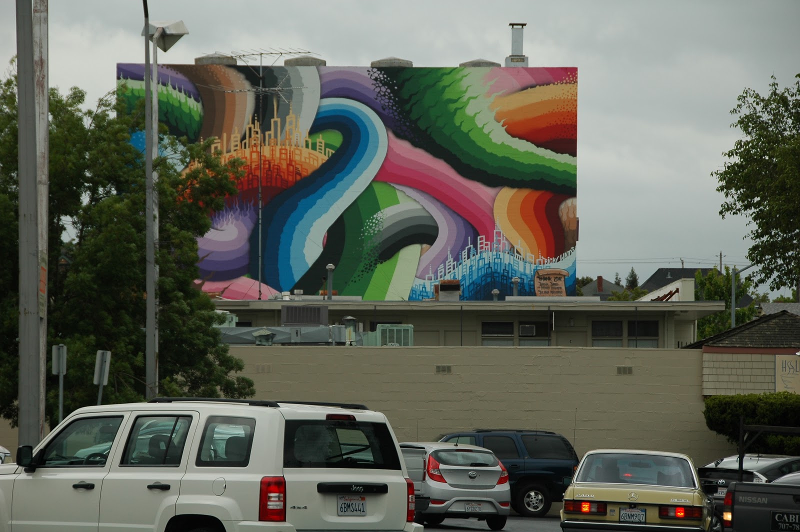
I previously wrote about a proposal to paint eight murals along American Alley in downtown Petaluma.  The Petaluma Planning Commission saw the opportunity as I had, approving the murals unanimously after only a short conversation.  The murals were completed over the weekend of November 7 and 8.

I wasn’t able to visit downtown during the mural painting weekend, but recently walked the alley, camera in hand, on a weekday afternoon.

It was an insightful experience.  The murals were much as had been proposed to the City, so it was like seeing old friends to amble down the alley and to come upon each mural looking both familiar and new.  But those who might have expected the murals to transform the alley would have been disappointed.  It was the same old American Alley, still utilitarian and still slightly dirty and smelly, but now with a hint of promise.

As Chuck Marohn of StrongTowns explained in a webinar early this week, the best urbanism is the urbanism that evolves slowly over time, incremental step after incremental step.  Urbanism that is brought to life fully formed will wear thin uniformly and may not adequately induce reinvestment thirty years hence.  But urbanism that is built incrementally and ages on a range of schedules will always be able to justify upkeep and regeneration.

The murals are one of those incremental steps.  They don’t completely change the alley, but they encourage more people to wander down a slightly tawdry alley.  And some of those people will visit the handful of shops along the alley.  And building owners, noting the increasing pedestrian activity, will find nooks and crannies for yet more shops.  If, ten years from now, American Alley is a bustling place, the weekend the murals were painted may be seen as a key step in the history of the alleys.

And, as recently noted by Sarah Goodyear in CityLab, the murals can serve to mark the alley as off-limits to the disreputable handful who would deface it with graffiti.

My favorite mural is the mosaic.  It’s not so much the design as the material choice.  I like adding one more texture to the range of textures already filling the alley, from the rough bricks with aging grout to the worn concrete driving surface to the newer stucco walls.  The mosaic seemed to add a grace note.

I can’t recommend visiting to downtown Petaluma to see the murals.  They’re not that impressive on their own.  But there are enough interesting places to shop and to eat in downtown Petaluma that I can recommend an outing there.  And as a part of your adventure, you really should wander over to American Alley to check out the new artwork.

In my next post, I’ll return to the subject of induced traffic.  I recently came across an article that does a fine job of explaining the concept in layman terms.  And I had a conversation with the staff of the Sonoma County Transportation Agency who gave me a different way to look at the subject.

As always, your questions or comments will be appreciated.  Please comment below or email me.  And thanks for reading. - Dave Alden (davealden53@comcast.net)

Wednesday, December 10, 2014

Finding Urbanism in the Local Paper

Once one begins to look at the world through urbanist glasses, there are urban-related stories all over.  There were two examples, one on downtown development and one on street speeds, in the most recent edition of the Argus Courier, the weekly Petaluma newspaper.

A year and a half ago, several members of Urban Chat took a Saturday morning walk through Petaluma.  The goal was to emulate the Jane’s Walks being taken throughout the country on the same day, honoring the contributions of urbanist pioneer Jane Jacobs.

Over the course of walk, a moment of insight came as we walked down the passageway from Kentucky Street toward Putnam Plaza.  We stopped to look both directions down American Alley and realized what a potentially great urban place it could be.  In the heart of downtown, lined with solid old buildings and interesting street art, close to transit and numerous retail stores.  Admittedly, the service uses of the alley, including store deliveries and garbage collection, would be a challenge to overcome, but other cities have found ways for urban life and urban services to coexist.

Eighteen months later, Frances Rivetti’s column in the Argus Courier is about new businesses coming to American Alley, with a new art gallery already open and a specialty food shop and a jazz club coming in the New Year.

I won’t claim that our walk or the resulting blog post had any role in the new development.  Instead, I’ll only note that our observations and the new economic activity are parallel signs that urbanism is becoming a shared vision.

Even with the good news of the businesses coming to American Alley, my favorite part of Rivetti’s column was her description of the alley as having “the quintessential urban chic of a backdrop for more student photo shoots than probably anywhere else in the area.”  One more piece of evidence that the coming generations are breaking free of the suburban model.

The same edition of the Argus Courier had a story about a family living on upper B Street whose cat had been killed by a passing car, a car that may have travelling faster than the 30 mph speed limit.  Upset by the feline death, the family was arguing for stop signs along their stretch of street to slow the traffic.

Although the City Engineer determined that the street didn’t meet the warrants needed to justify a new stop sign, the City Council expressed sympathy for the family along with a willingness to look for solutions.

To begin, I’m fully sympathetic with the family’s loss.  My wife and I have three dogs and live on a local street not far from B Street.  We’re constantly aware of the risks from the passing traffic and work hard to keep the dogs safe.

But with that said, the family has identified the wrong solution.  Stop signs don’t noticeably slow peak travel speeds.  Where my wife and I live illustrates the point.  Our block has a 25 mph speed limit and stop signs at both ends of the block.  And yet we often note travel speeds of 30 mph or above, as drivers accelerate to make up for the time they’ve lost by obeying the stop signs.  (Being a prime driving route to Petaluma High also doesn’t help.)  The problem is sufficiently evident that the Police Department occasionally stations cruisers on the street.

So stop signs aren’t a solution.  The real problem is the speed limit itself.  At the 30 mph speed limit on B Street, not only are people more at risk, with pedestrians far more likely to die in collisions with cars than when speed are lower, but drivers are less likely to see loose pets and pets have fewer opportunities to dodge approaching cars.

However, speed limits the direct result of the road design.  As I’ve written before, California speed limits are set by the speed at which we drive.  Build a wider street with fewer elements to reduce speed and people will drive more quickly, resulting in higher speed limits.

By my measurement, B Street is 44 feet wide, unfortunately wide for a street with its level of traffic.  On a recent afternoon, I observed B Street traffic for a few minutes, during which eight cars passed me traveling downhill, a direction for which a City-installed speed measuring sign was displaying velocities.  Of the eight cars, only one exceeded 30 mph, with the others traveling from 2 to 10 mph slower.  It was a small sample, but if a larger sample maintained the same pattern, a 30 mph speed limit would be consistent with the data.

But what if 30 mph isn’t good for the neighborhood or for the pets in the neighborhood?  What can we do?  Under the law, the options are limited, but there may be a few possibilities.  Drivers are sensitive to their travel space and will drive slower when they feel more confined.  For B Street, my suggestion would be start with a couple of gallons of paint.

Today, B Street is divided into two 12-foot driving lanes and two 10-foot parking and bicycle lanes.  It’s a fairly common pavement allocation, but it’s worth noting the most freeways also have 12-foot lanes.  What if we repaint the bike path lines two feet closer to centerline, reducing the travel lanes to 10 feet and widening the bike/parking lanes to 12 feet?

Bicyclists certainly wouldn’t complain about the extra width and the reduced chanced of being “doored” by newly parked drivers.

And ten feet for cars isn’t unreasonable, with the SmartCode that governs much of downtown Petaluma calling for 10-foot lanes on many streets.  (Please ponder the irony for a moment.  The travel lanes on B Street, a quiet residential neighborhood, have more in common with freeways than downtown.  That’s not right.)

It’s been shown that drivers faced with a more confined space, even if only in paint, feel more confined and reduce their speed.  It’s possible that ten-foot lanes on B Street would reduce the speed limit to 25 mph.

And the paint is cheaper than the stop signs, along with likely being more effective.

But perhaps 25 mph, although the lowest speed limit generally allowed in California, still isn’t slow enough.  I’ve previously written that many argue for 20 mph on most streets under the slogan “Twenty is Plenty”.  A speed limit that low would take legislative action, but could change our communities.

And there’s a precedent for an all-encompassing change to lower speeds.  Recently, the administration of New York City Mayor Bill De Blasio implemented new rules reducing the speed limits on most New York streets to 25 mph.  It’s not 20 mph, but it’s a step in that direction and shows the growing momentum of the “Twenty is Plenty” movement.  (It also provides another point of irony to ponder.  While most of New York City now has a 25 mph speed limit, we continue to allow cars to drive through North Bay residential neighborhoods at 30 mph.)

We don’t need any more cats killed. And we don’t need any more pedestrians at risk.  But stop signs aren’t the solution.  Lower speed limits are, whether by paint or by legislative action.

As I was buttoning up this post, an email arrived from StrongTowns with a new post from founder Chuck Marohn about road design and traffic safety.  The pedestrian fatality that he uses as the focus of his post was the result of a different traffic problem than B Street, but the comments that Marohn makes about the state of roadway design are dead on target and worth your time.  Read it.  It may change how you think about traffic safety.

And as you continue your day, keep your eyes open for urbanist insights.  They’re all around us.  I know I’m eagerly awaiting the next edition of the Argus Courier.

Next time, I’ll share a story about an attempt to implement the “fine-grained urbanism” endorsed by Jane Jacobs.

As always, your questions or comments will be appreciated.  Please comment below or email me.  And thanks for reading. - Dave Alden (davealden53@comcast.net)

Monday, May 6, 2013

Jakes’ Walk: The Debriefing and the Future

Two months ago, I suggested the route for a possible walk through downtown Petaluma.  I hoped that readers would propose their own urban walking routes, either in Petaluma or in other North Bay cities.  One reader forwarded several walking routes that he had prepared for a Rotary club several years earlier, a couple of which included downtown Petaluma.  But otherwise, no one rose to the challenge.

However, several people indicated an interest in taking the walk that I had outlined, which I called Jake’s Walk after a canine walking companion.   This past Saturday was picked for the walk, although the frequently over-exuberant Jake was left behind.

The day worked out well.  There were only three of us, but it was well-matched three.  We ambled slowly through the town, stopping frequently to talk about a well-formed tree on B Street, the history of the plaza in front of St. Vincent’s Church, the new Ricky Watts mural, the potential of American Alley, and the missed opportunities along Water Street.


The American Alley talk was particularly interesting, with the shared vision that the alley might be turned into a pedestrian wonderland if problems such as emergency access and solid waste collection could be solved.  We were particularly enthralled by the possibility of an entrance directly into the used book room of Copperfield’s Books.  There was the concern that one end of the lane ends on E. Washington Street, which lacks pedestrian friendliness.  But we were only prepared to solve one problem at a time. 

By the time we’d finished a leisurely lunch of paninis and draft beers at the recently opened Corkscrew, we’d spent more than three enjoyable hours in enlightening conversation.

I think we should build on this auspicious start.  With summer rapidly approaching, I know that family schedules are well-booked.  But I’ve set a couple of fall dates.  Please put them on your calendars.

On Saturday, September 21, starting at 11am, we’ll do a Jake’s Walk in Windsor, taking a close look at the urbanist thinking behind Windsor Town Green and the development around it.   If a reader from Windsor can propose a route, that’d be great.  If not, I can assemble a plan from my visits to Windsor.

On Sunday, October 20, starting at noon, we’ll do a reprise of the original Petaluma Jake’s Walk, hopefully with more folks to supplement the original three.

The goal of both walks will be the same, to observe the urban context and to talk about what works, what doesn’t, what the future opportunities might be, and how the planning process helps or hinders urbanism.
Jake’s participation in either walk remains uncertain.  I think having dogs come along would be fine, but Jake needs to acquire a few more manners before he can join the group.

As always, your questions or comments will be appreciated.  Please comment below or email me.  And thanks for reading. - Dave Alden (davealden53@comcast.net)